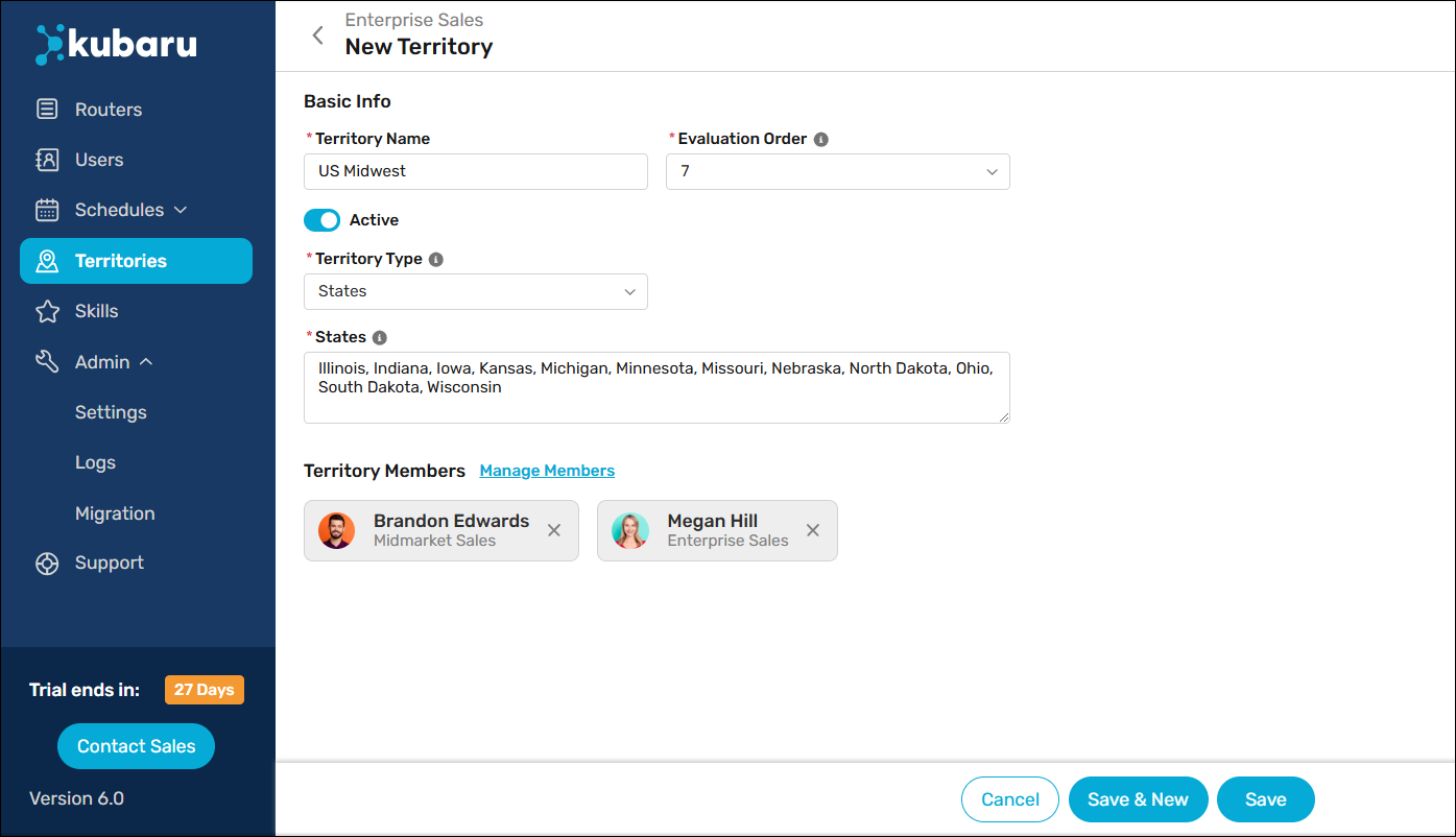
Territory routers can assign records based on the geographic territories you define. Territories can be defined based on countries, states, zip/postal codes, and other boundaries.
Follow these steps to define a new territory:
- Select Kubaru from the App Launcher menu.
- Click the Territories tab in the navigation menu.
- Click on a Territory Group.
- Click the New Territory button.
- Enter a name in the Territory Name field (e.g., “US Midwest”).
- (Optional) Change the Evaluation Order. Note: records are evaluated against territories in order starting with 1.
- Select one of the following Territory Type options:
| TERRITORY TYPE | DESCRIPTION |
|---|---|
| Countries | Define territory boundaries based on countries. For example, you might create a territory named “Scandinavia” that includes the countries of Sweden, Norway, and Denmark. |
| States | Define territory boundaries based on states. For example, you might create a territory named “New England” that includes Connecticut, Maine, Massachusetts, New Hampshire, Rhode Island, and Vermont. |
| Zip/Postal Codes | Define territory boundaries based on zip/postal codes. For example, you might create a territory named “Downtown Chicago” that includes 60601, 60602, 60603, and 60604. Tip: use an asterisk (*) as a wildcard to simplify zip/postal codes entries. For example, entering ‘970*’ will match any zip/postal code starting with 970 (e.g., 97006, 97020, etc.). |
| Other | Define territory boundaries based on any other standard or custom field (e.g., county, city, etc.). Note: See Territory Object Mappings for instructions on how to map “Other” to a specific field. |
| Mixed | Define territory boundaries based on any combination of the above. Note: This option is only visible if you have enabled Use AND Logic For Territory Boundaries (beta). This setting can be found in Admin > Settings > Advanced > Beta Features. |
- Enter one or more values in the Countries, States, Zip/Postal Code, and/or Other fields. You can enter multiple values separated by a comma or a line break.
- Click Add Members to select one or more users to assign to the territory.
- Click Save.

Things to keep in mind
